
WebGIS Application Development Services
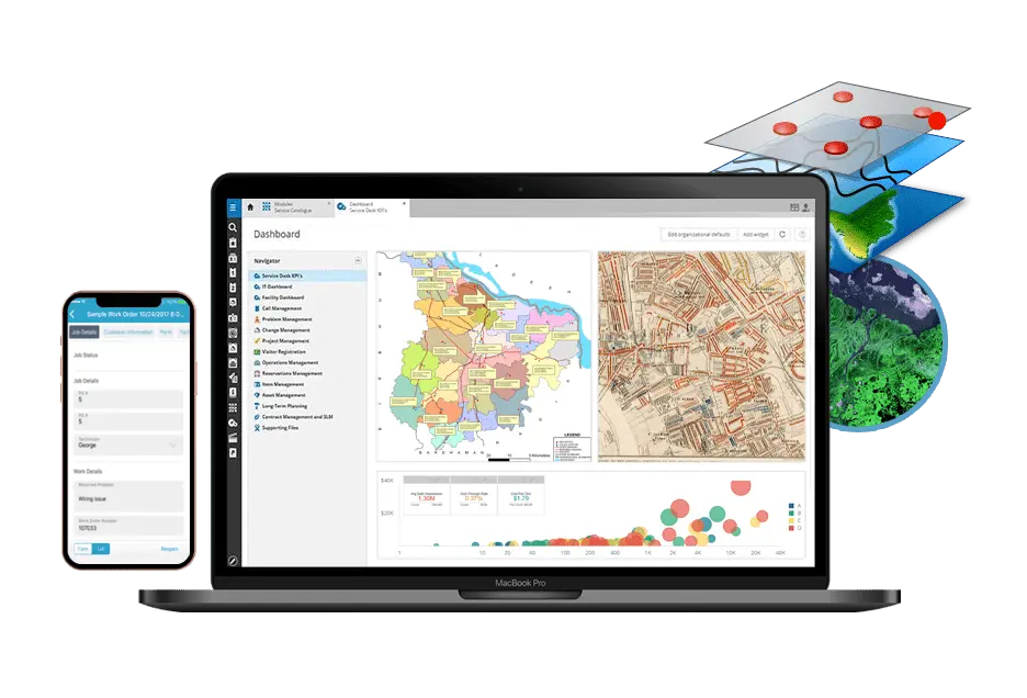
In today’s digital era, location is the key commodity of smart decision making. WebGIS development combines mapping technology with the power of the internet, making geographic information accessible, interactive, and actionable from anywhere. That’s why we specialize in WebGIS application development that brings spatial data to life through interactive maps and powerful geospatial tools. We build powerful, user friendly dashboard that helps to users to visualize, analyze, and share geospatial information in real time. Our solutions are built to support industries such as location based services which includes several technologies like Google Maps API, GeoServer, Spatial Database, OpenStreetMap (OSM) API and GeoJson
WE WORK HARD WE PLAY HARD
Our Services
Maps APIs
We provide the Maps API service to add useful features to your websites. Add interactive maps, real-time position monitoring, and route optimization to enhance the user experience for your users and help them find their way.
Leaflet APIs
We offer Leaflet API's services to make your interactive website or app and also user can explore locations, see custom markers, and navigate smoothly, all while keeping things quick and simple.
Geo Databases
We integrate spatial databases with application and ensure that all location based data is storing and managing in the database.
Geoserver Integration
We integrate Geoserver to deliver spatial and non spatial data on the application by using Open layers. With Geoserver, we manage, share, and display geographic data on the user's application that makes the interactive interface
Location-based App Development
We provide interactive apps that use real-time location data to provide personalized experiences and also provide the features of navigation and geofencing
JSP/Servlets
We specialize in JSP and servlets language to make an app with the integration of spatial databases, PHP and Geoserver by using Apache and Tomcat servers.
Why Choose Us

Focus on Requirements
We Focus on client's requirements to deliver solutions precisely aligned with project goals

Reliable Solution
Our web development company provide reliable solutions that ensure consistency, quality, and long term performance

Experienced Team
We have an experienced team delivering expertise, innovation, and proven results across projects

Affordable Pricing
We offer affordable pricing that ensures high quality solutions without exceeding budget limits

Fast Delivery
We provide fast delivery, ensuring projects are completed on time without compromising quality

24/7 Customer Support
We offer 24/7 customer support, ensuring assistance is always available whenever needed
WE WORK HARD WE PLAY HARD
Our Services
Frequently Asked Questions
In WebGIS application, Google Maps, OSM and Leaflet APIs are used in frontend side while on server side JSP, PHP and Servlets languages are used and on database side postgis, mysql spatial databases as well as Geoserver (WMS, WFS) are used
Apache/Tomcat servers provide significant security features, such as support for SSL encryption and safe application deployment. They also send out monthly security upgrades to keep your website safe from bugs and assaults.
Apps that incorporate location make it easier and more relevant for users to engage with one other. Your app can improve the user experience and make customers more loyal by offering features like real-time navigation, suggestions based on location, or activity monitoring.
Yes, GeoServer is built to handle big datasets well. It can handle and serve huge amounts of geographic data, therefore it works well for apps that need a lot of spatial data without slowing down.